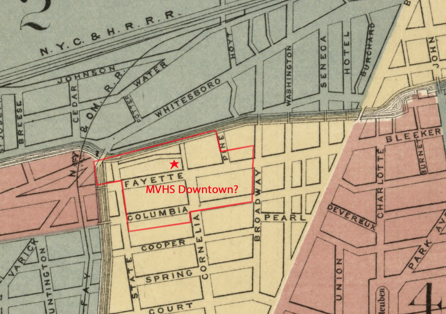
CoLa Maps
Below are maps, illustrations, and photographs showing the development of Downtown Utica and the Columbia-Lafayette Neigborhood.
Records reveal Furnace & Boiler Manufacturers started here and a few Buildings & Carton Avenue remain, offering Utica a great opportunity! Read additional background on Utica's Development.
1817
In 1816 the population, per the Utica City Directory, was 2,861, up from 1,700 in 1813. The below map is one used to survey for construction of the Erie Canal. Only Liberty and Whitesboro Streets strecth west of Genesee Street. State, Fayette, and other streets did not yet exist...
In 1820 Utica's population grows to 2,972, then jumps to 4,017 in 1823.
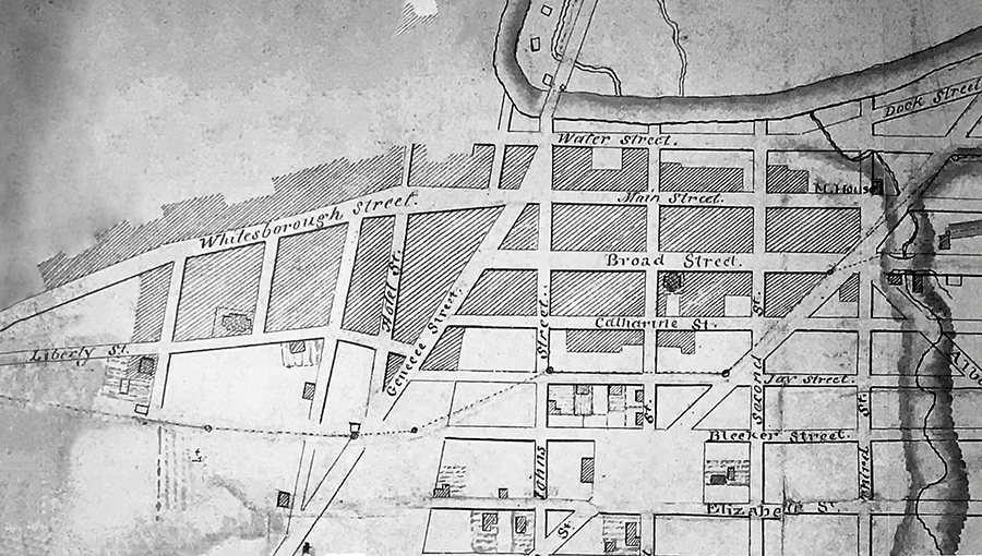
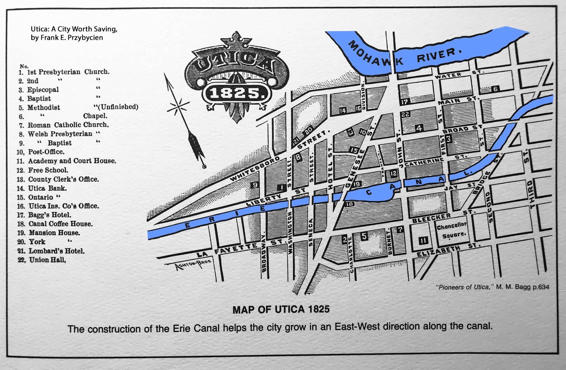
1825
The street grid has expanded, now Fayette Street (mislabeled as Lafayette) and the Erie Canal also run east to west. West of Broadway are Pine (one block long) and Cornelia Streets, but the present-day WynnBUD area is largely undeveloped.
Per Utica City Directories population between 1825 and 1830; 5,050 (1825), 7,466 (1828), and then 8,323 (1830).
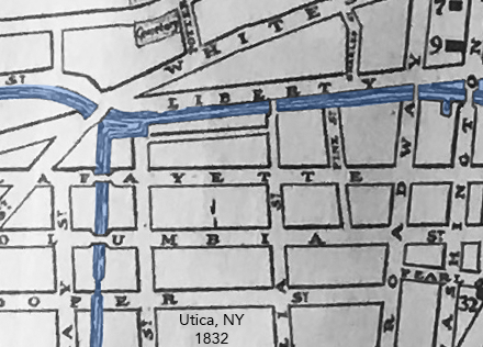
1832
The Chenango Canal is shown, as well as a basin where the canals intersect. A one block street, running parallel to the Erie Canal between State and Cornelia, appears. While not labeled here, probably called Rome Street and later becomes a portion of Carton Avenue.
1839
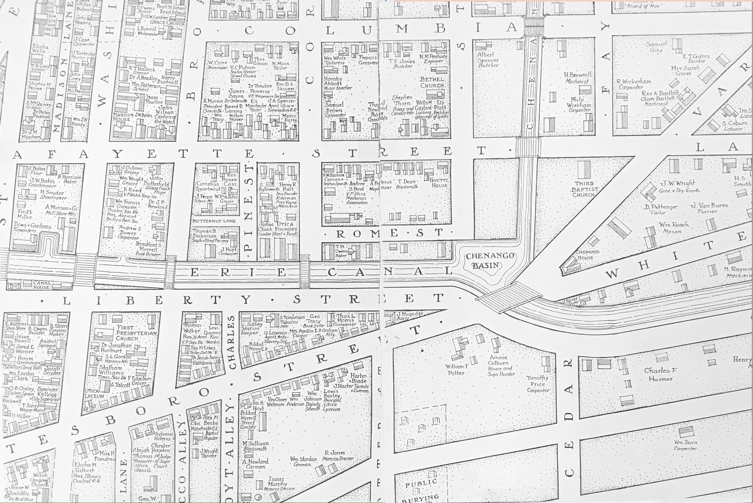
An early view showing Rome Street and two canals in 1839; the Erie and Chenango. Where canals intersect is the "Chenango Basin".
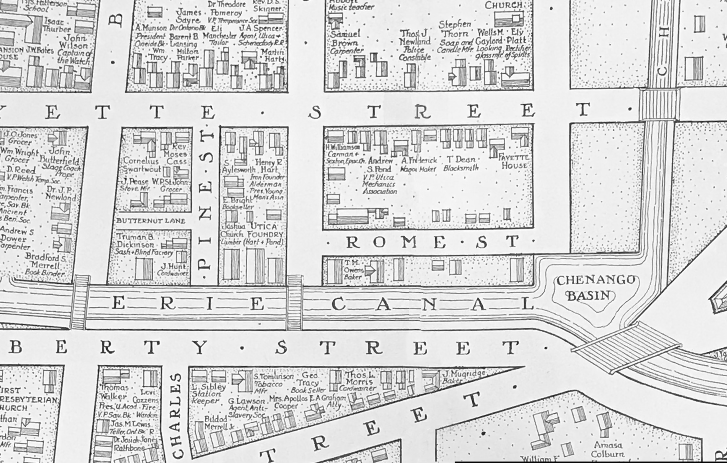
One resident shown is Andrew S. Pond, VP of Utica Mechanics Association. His neighbors to the west are a "wagon maker" and a "blacksmith." Located west of Pine Street are "Utica Foundry" owned by "Hart & Pond," and south of them is "Henry R Hart" an "Iron Founder." On the block south of Butternut Lane is "J. Pease" a "Stove Mfg." Martin Hart's home is located at the corner of Lafayette and Cornelia Streets.
Pond, Hart, and Pease will emerge as well-known names affiliated with Utica Stove, Furance and Boiler-making Companies.
View another Larger 1839 Map. In 1850 Utica's population stands at 17,565.
1873
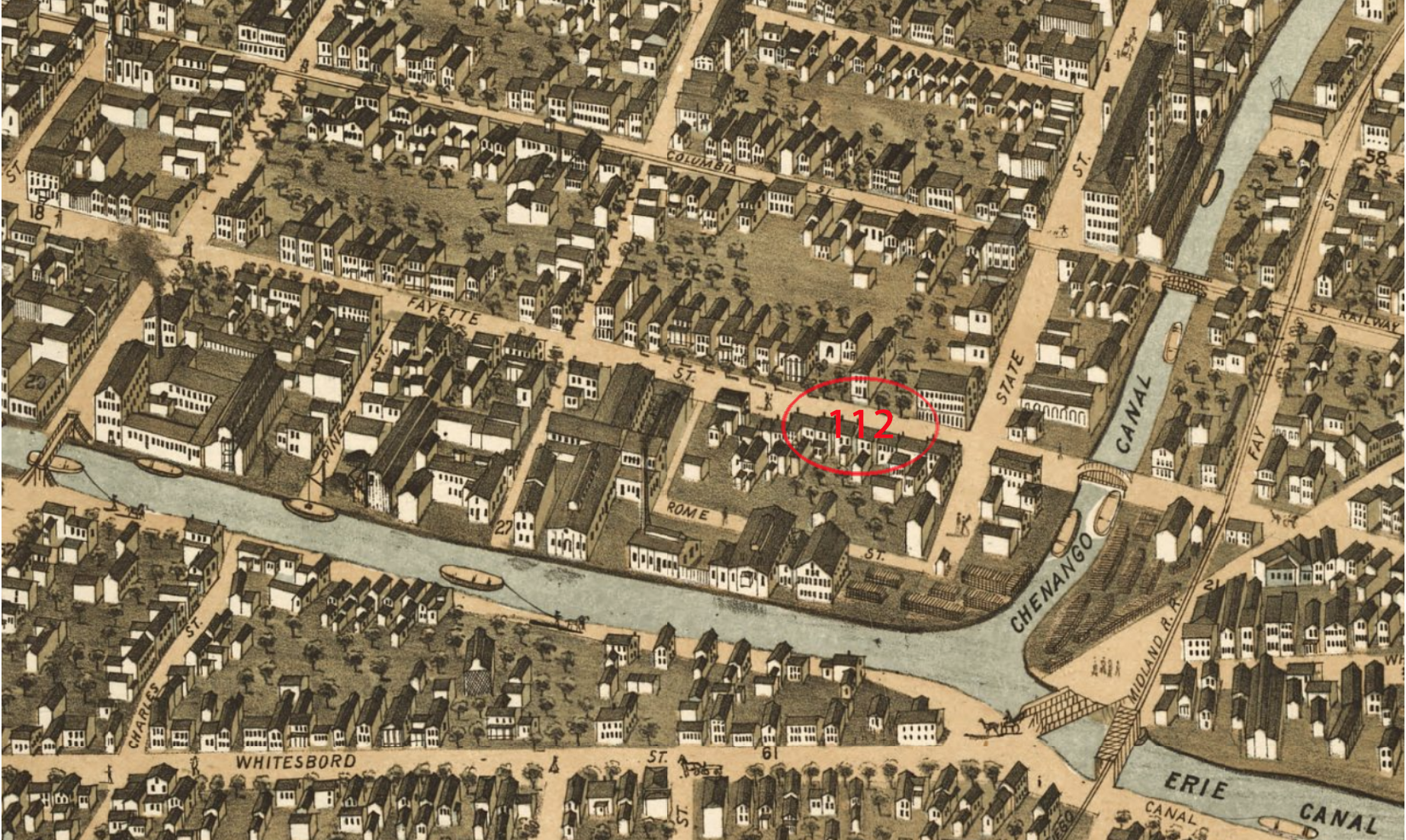
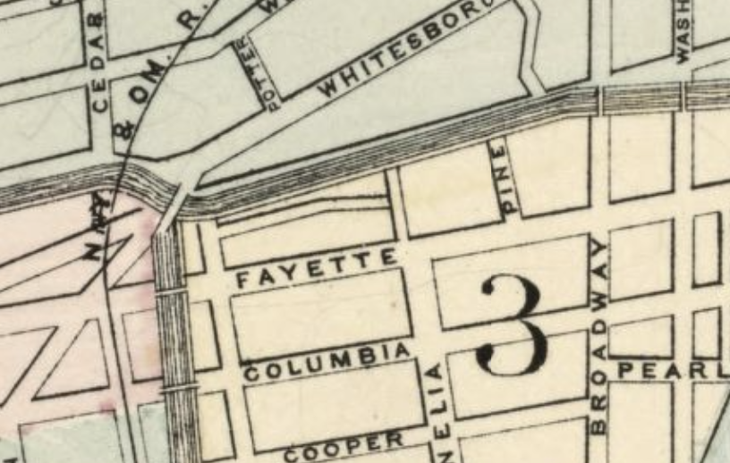
As shown in the below "birdseye" illustration, a factory expansion (Utica Steam Gauge Co.) prevents Rome Street from reaching east to Cornelia as it bends southward into Fayette Street. In a cluster of factories, shops and homes, current-day 442 Lafayette can be seen as 112 Fayette Street. Rome Street no longer intesects Cornelia (factory is erected, see Utica Steam Gauge on 1883 map below), but turns south into Fayette Street. Also the Chenango Basin is consumed due to widening of the canals.
On each bank of the Chenango Canal, where it meets the Erie Canal, are coal yards...
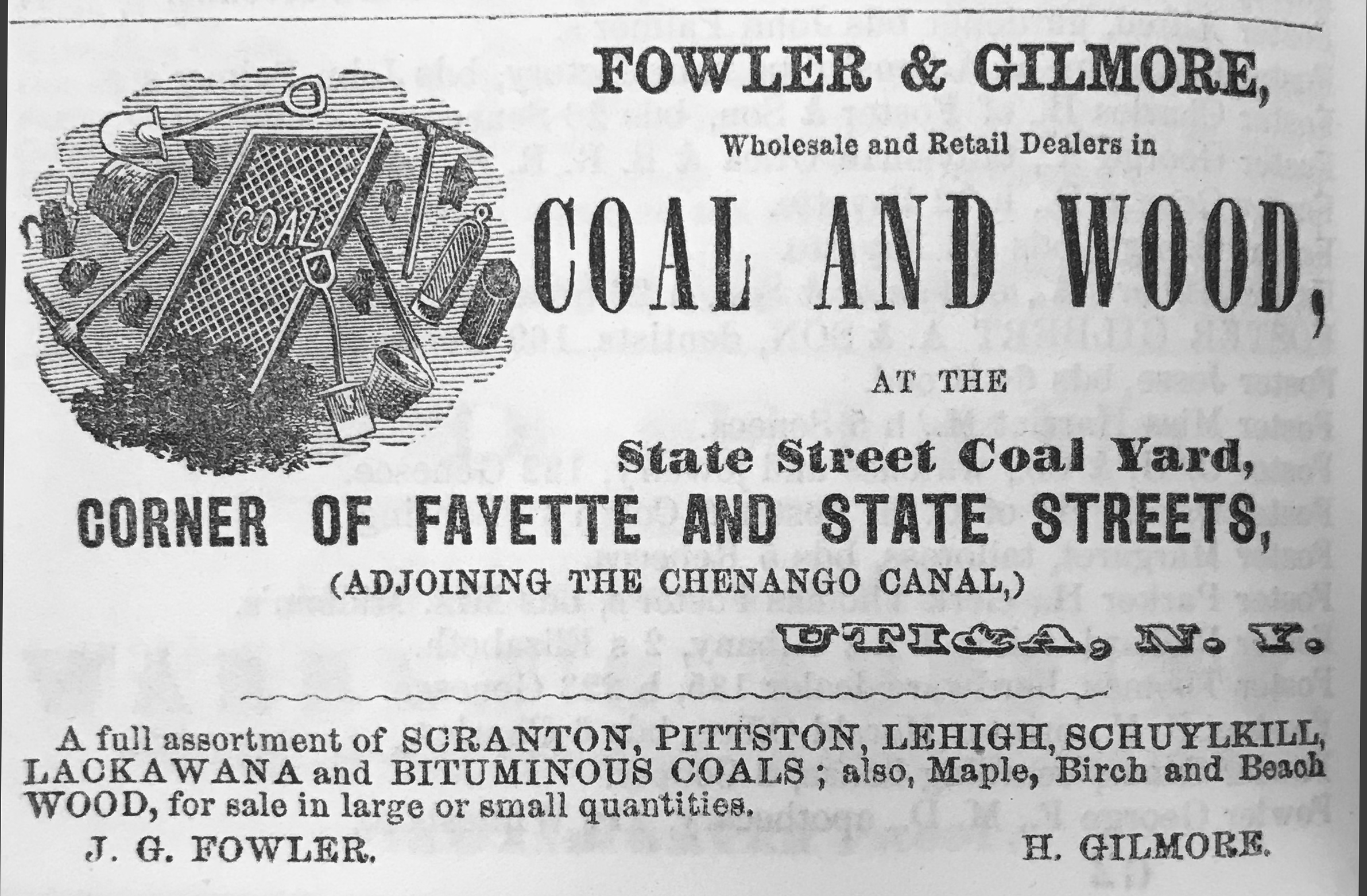
The above Fowler & Gilmore advertisement reads...
A full assortment of SCRANTON, PITTSTON, LEHIGH, SCHUYLKILL, LACKAWANA and BITUMINOUS COALS; also, Maple, Birch and Beach WOOD, for sale in large or small quantities.
J. G. FOWLER
H. GILMORE
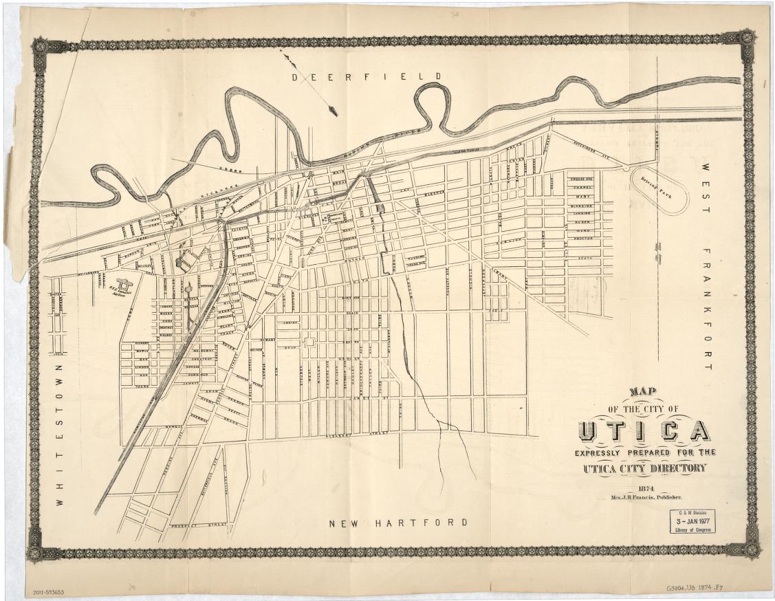
1874
The street grid of a growing city as it appeared in 1874...
Another 1874 map, showing just the commercial buildings in and around the Columbia Lafayette Neighborhhood...
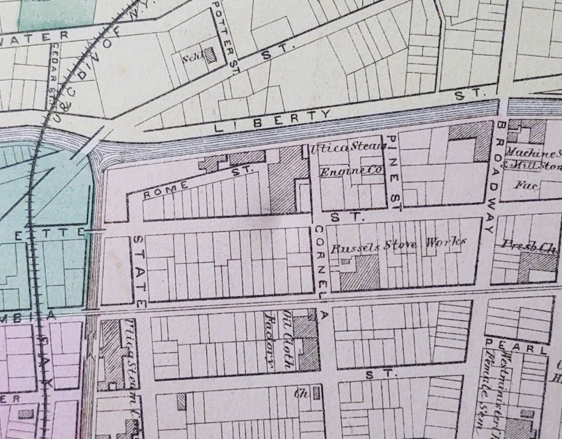
Utica Stean Furnace Works and Russels Stove Works are identified along what was then called Fayette Street. Not labeled, just north of Rome Street and between the Eire Canal are likely Carton Furnace Company buildings.
1876
1877

1880
See the complete 1880 City Of Utica Map.
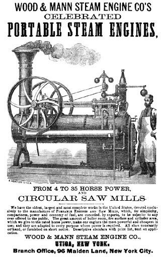
1883
Utica's population has surpased 40,000 residents and its canals and trolley tracks are well established. The Wood & Mann Engine Works rests on banks of Eire Canal at Rome Street. Today's Lafayette Street was then called Fayette Street and C.S. Bington occupied a brick residence at No. 112, now known as 442 Lafayette Street...
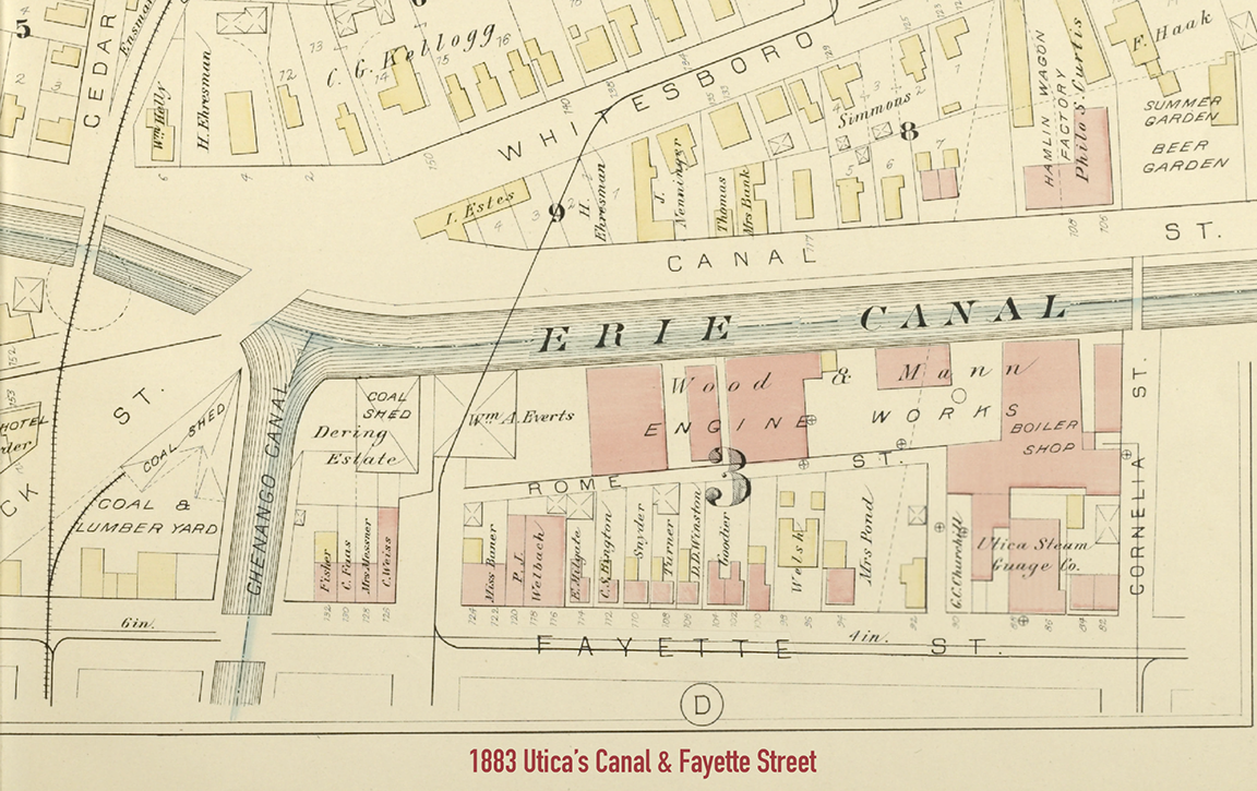
The Utica Steam Guage Company is shown on Cornelia Street. Present day 442 is shown at 112 Fayette, square brick building with wooden shed attached...
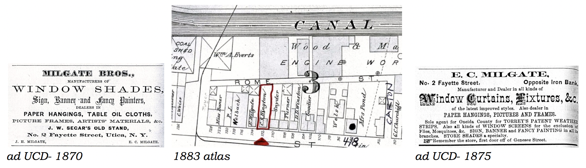
A neighbor to the west, at 114 Fayette is Edward C. Milgate. Shown to be a manufacturer of window shades with a store located "one door off Genesee Street." Sixteen years later in 1899, the Utica Directory indicates E.C. Milgate and Peter E. Dressel occupied 112 Fayette Street.
1884
Rome Street is not labeled, nor fully drawn. Perhaps an error or maybe a growing J.W. Carton Furnace Comapny has reduced it to working alley way? Coles Hotel is located at 94 Fayette Street and along the canal at Cornelia is the Russel Wheeler Company...
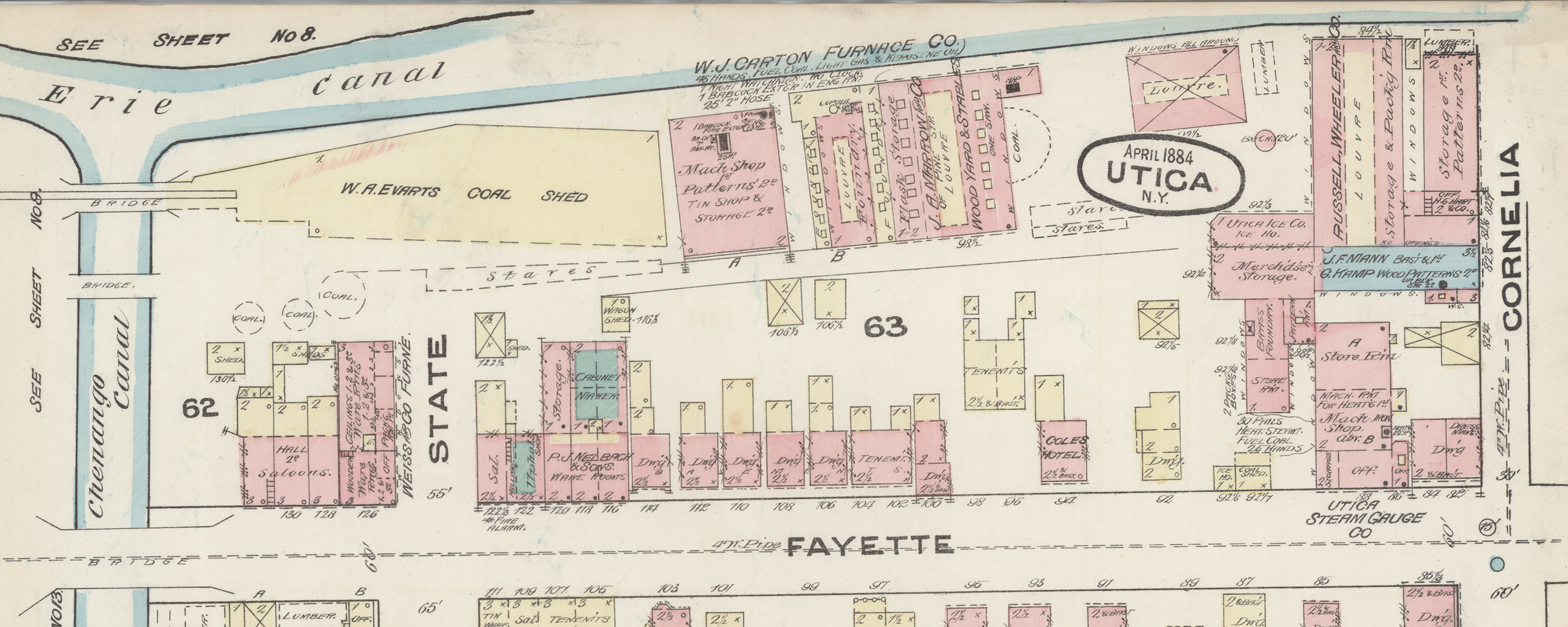
Furnace makers W. J. Carton Furnace Co and Russell Wheeler Co appear in above map. View complete 1844 Map showing the State Street Steam Mills.
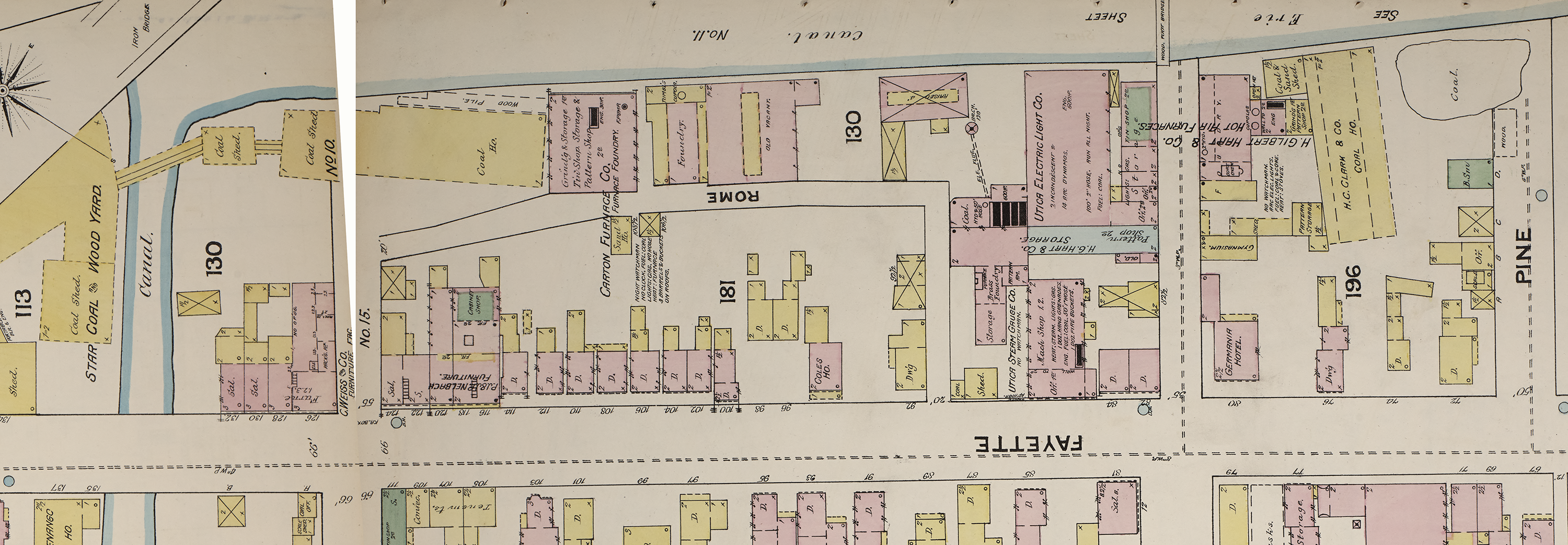
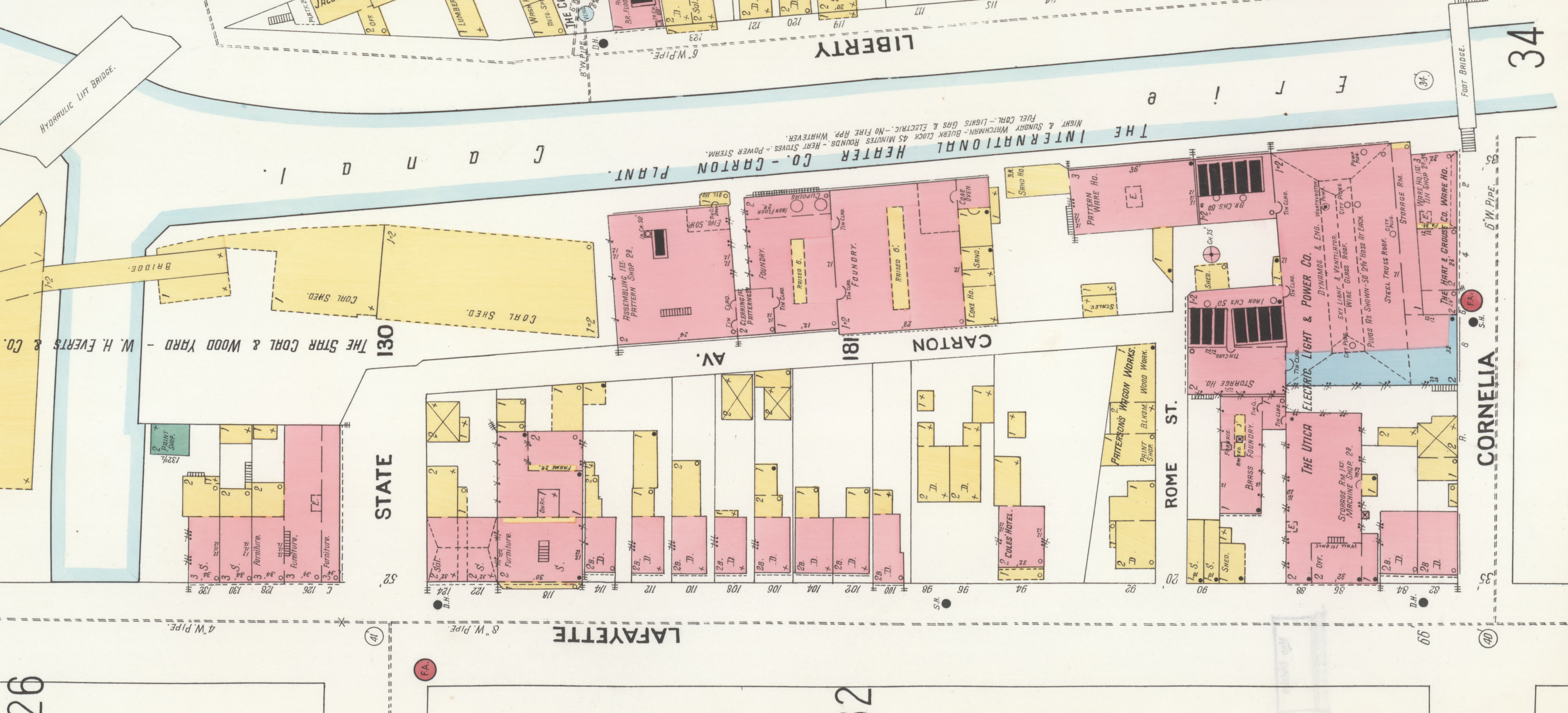
1888
Rome Street is shown and turns southward to intersect with Fayette Street. The Carton furnace factory remains, however Russel Wheeler is not shown, but apparently replaced by the Utica Electric Light Company. Further east, one sees H. Gilbert Hart & Co. Hot Air Furnaces...
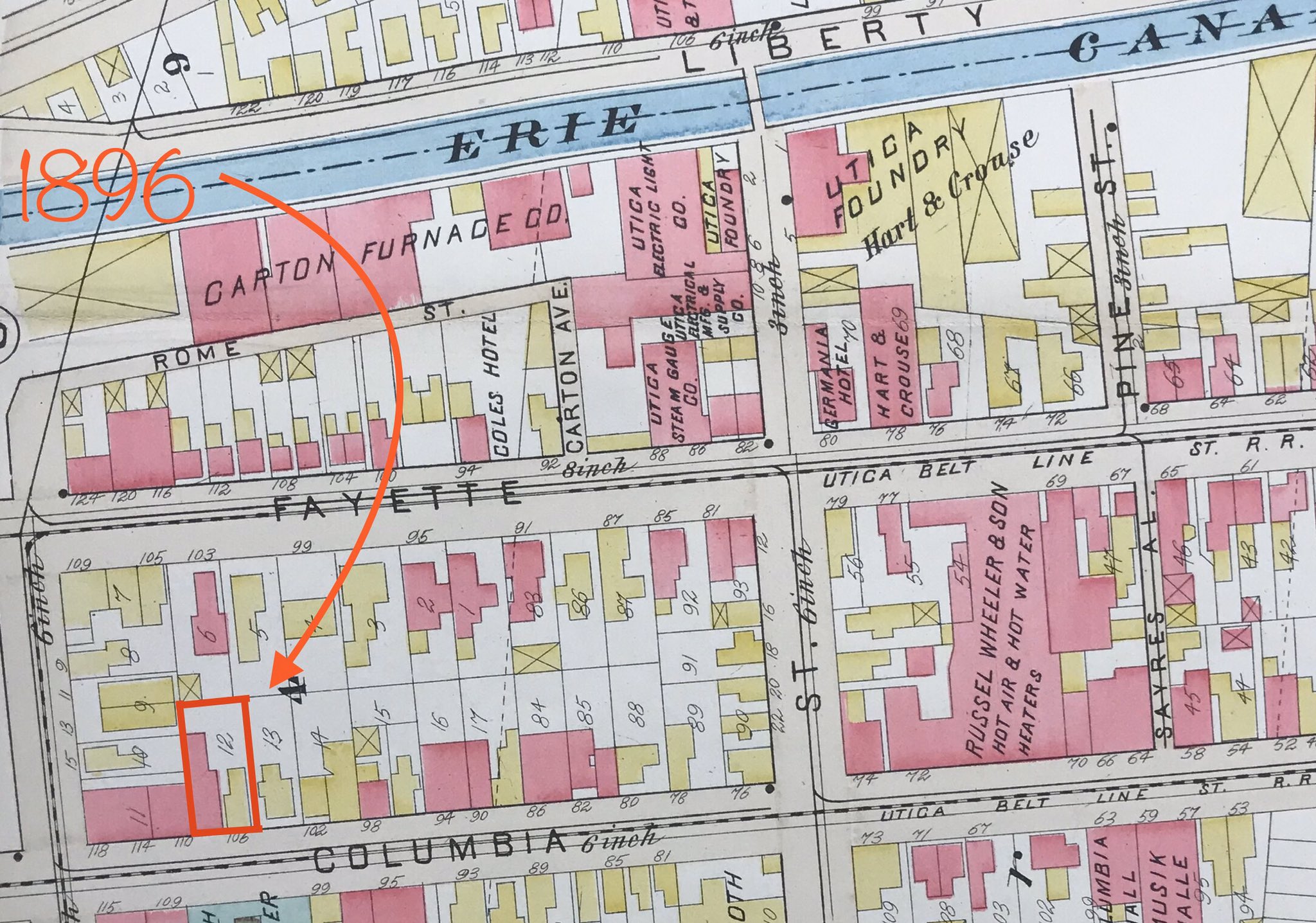
1896
Both Rome Street and Carton Avenue are shown. Also in neighborhood are Carton Furnace Company, Hart & Crouse, Utica Steam Gauge Co, and Russel Wheeler & Son. Trolley tracks appear as well, "Utica Belt Line St. R.R."
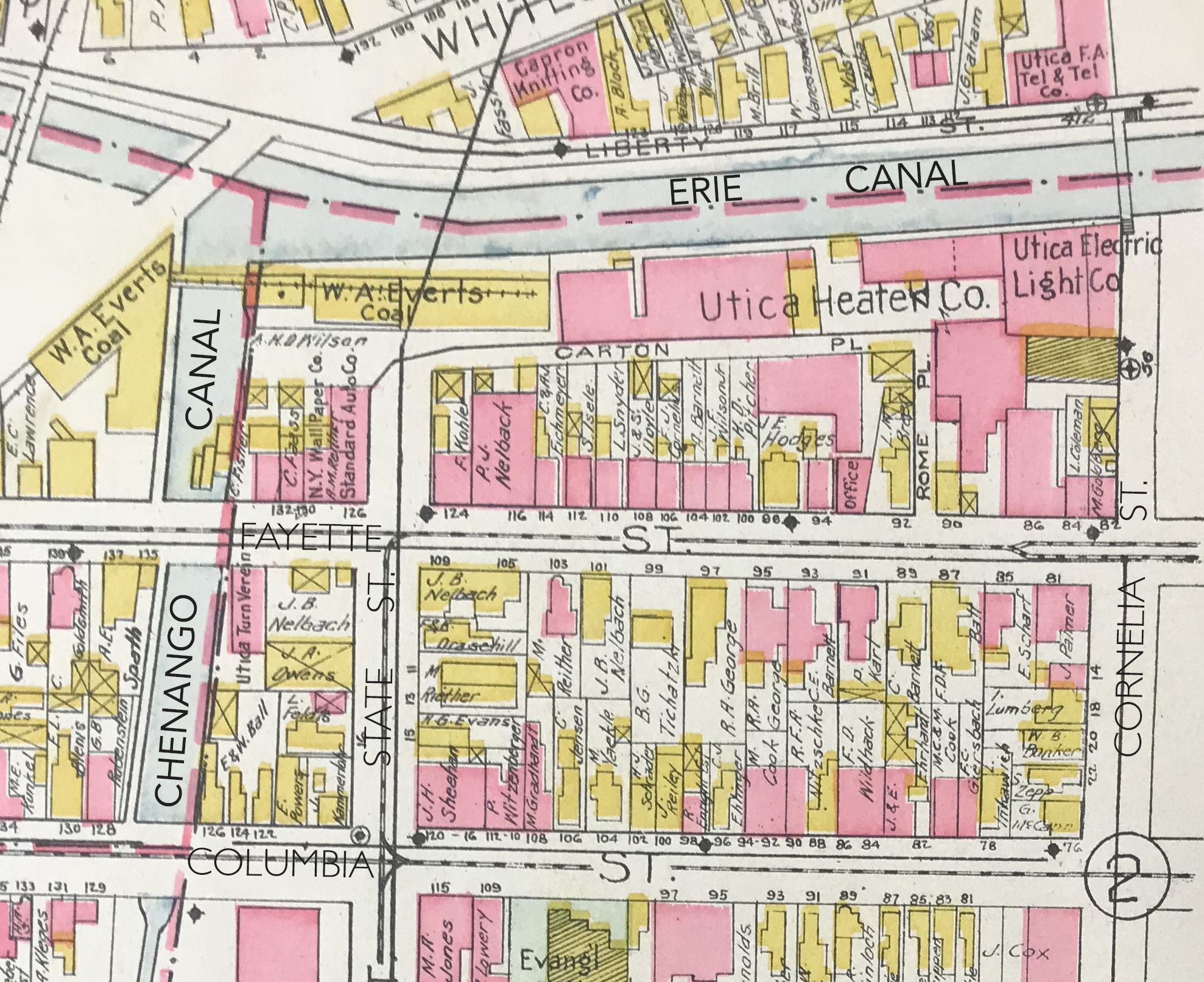
1899
Furnace company now labeled "The International Heater Co. - Carton Plant." Both Rome Street and Carton Avenue are shown, yet the street labels/street sections have flip-flopped! On Cornelia Street, "Hart & Crouse Co." is located alongside the canal.
1899: The International Heater Co, Carton Plant
1900 - Utica population reaches 56,383.
1907
Streets Rome and Carton are now labeled as Rome Place and Carton Place. Also present is the Utica Heater Company. 112 Fayette Street has an additional wooden structure attached and occupied by "C. & A.J. Eichmeyer". The parcel at 94-96 Fayette (Coles Hotel site) has new buildings and appears owned by a one "J.E. Hodges."
1910 - Immigrants from southern and eastern Europe continue to pour into Utica, population nears 75,000 (an increase of 20,000 in last 10 years).Ref.
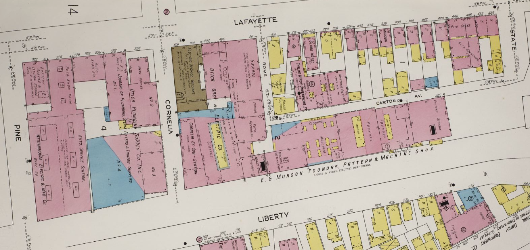
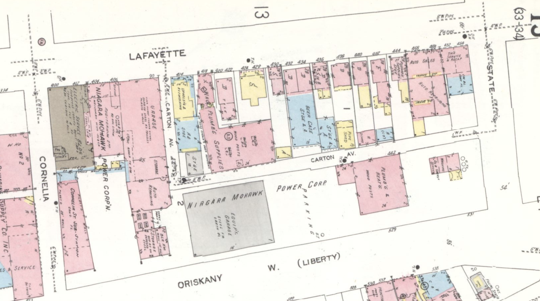
1925
The large factory shown alongside Carton Avenue is called "E.G. Munson Foundry, Pattern & Machine Shop." Rome Street shown here as the shorter leg of the cobblestone roadway. At 418 Lafayette is a company called Tailor Made Underware, with the adjacent building Labeled "Mattress Factory." The former Coles Hotel appears expanded and called "Globe Hotel" at 420-422 Lafayette Street. 442 Layfayette has also expanded with into a rectangular brick building. Liberty Street appears where the Erie Canal was.
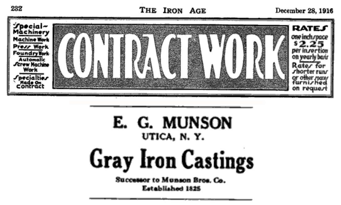
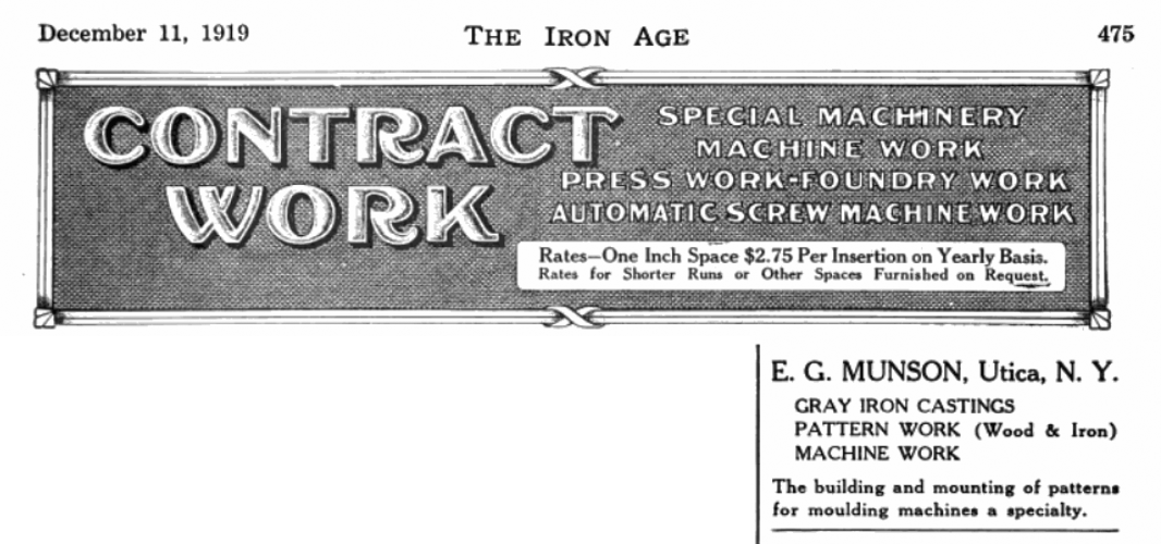
View advertisements for the large foundry;
1916 - E.G. Munson Foundry and
1919 - E.G. Munson Foundry.
1930 - Utica population stands at 101,740.
1952
This section of Liberty Street renamed "Oriskany Street West", fomer path of the Erie Canal.
1950's
1964

Learn more about Utica's Urban Renewal projects.
1967

2016

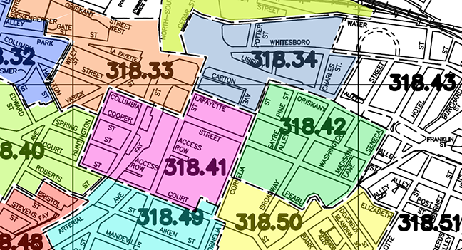
Parcel Map Index
We're not opposed to a new hospital... just don't bulldoze Downtown Utica's Historic Columbia-Lafayette Neighborhood... "Build It At St. Luke's!"