Utica's CoLa Neighborhood
As we work to save the Columbia Lafayette Neighborhood from further demolition and Urban Renewal, we're branding ourselves. Explore the CoLa Neighborhood.
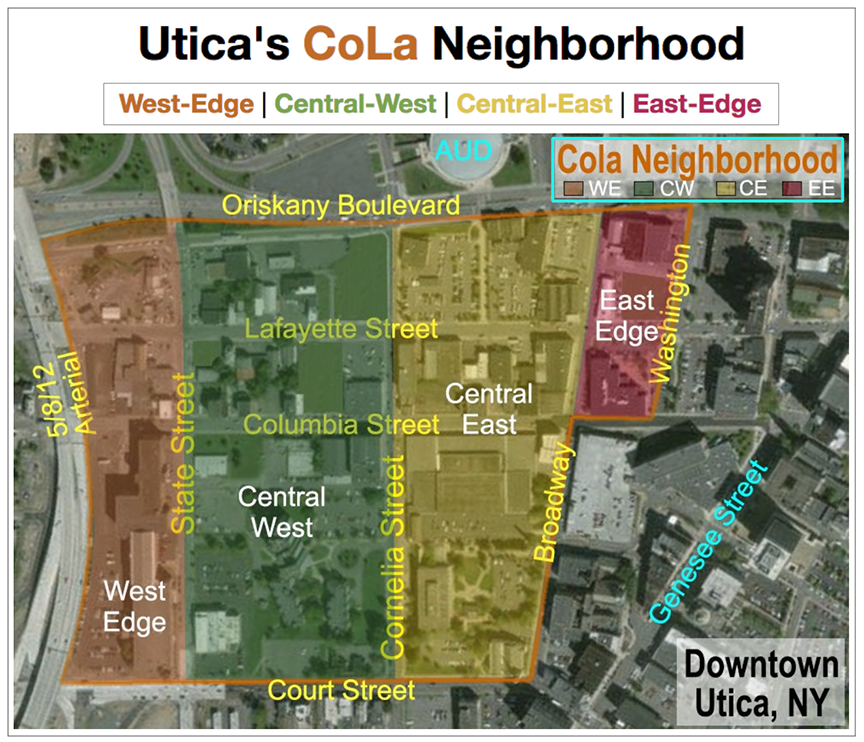
CoLa consists of approximately 61 acres located "east-to-west" between Broadway/Washington Street and the New 5/8/12 Arterial, and "north-to-south" between Oriskany Boulevard and Court Street...
We’re defining a renewed Downtown Utica neighborhood, called “CoLa”...
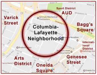
In too many parts of downtown, buildings have been razed for surface parking. CoLa is critically important, as it ties together many neighborhoods; the Genesee Street Business Corridor, the Varick Street & Brewery District, Bagg's Square and the rapidly expanding AUD, plus others including the Art's District.
CoLa is next in line to further other recent Downtown Utica Developments. Learn more about CoLa's Streets & Alleyways; Past, Present & Future.
In addition to the 40+ Businesses originally targeted in the hospital site concept, this neighborhood is also home to; Utica City Hall, Utica Police Complex, Utica City Courts, Kennedy Apartments, and a long string of mill buildings bookended by Brodock Press / The Lofts At 502.
Properties and parcels of CoLa Neighborhood have been defined into four block groups...
Central-West
Central-East
East-Edge
Looking to define ourselves further, “Block Groups” (WE, CW, CE & EE) are applied to the Columbia Lafayette Neighborhood’s developing identity... https://t.co/HgUsuD6jvD #walkable #historic #connected #downtown pic.twitter.com/aqbOBl10vI
— BetterUticaDowntown (@BudsforBUD) October 12, 2018
You may explore how others investigate and perform Neighborhood Branding & Marketing. We also recommend this TEDx Talk by Michelle Truett, "Microbranding Utica Mile by Mile".
We organized CoLa by Block Groups. We're also creating an Interactive CoLa Map of proposed redevelopment concepts in area targeted by the Downtown Utica Hospital Concept.
BetterUticaDowntown believe these plans far superior to bulldozing 25-34 acres of CoLa for the ill-conceived hospital. Utica has seen too much destructive Urban Renewal already.
We're not opposed to a new hospital, just do not bulldoze Downtown Utica's Historic Columbia-Lafayette Neighborhood... "Build It At St. Luke's!"